Day One - July 17
Glenn Highway North
Our first clue that
Alaska is different than the lower 48 comes immediately upon landing at Anchorage
International Airport. We expect the terminal to be deserted at 1 a.m., but to our surprise, people are boarding planes, shopping and dining like it is mid-day. Family and friends with dogs and children greet newly arrived passengers in the baggage area. The long days definitely keep people out and about all evening.
After a few hours sleep, we start the day anew at 10 a.m. We decide to explore Alaska by land in our typical style. Rent a car, get some
maps and figure it out from there.
Our first stop is Palmer, about 45 miles northeast of Anchorage. We meet Kathy and Dave, who winter in Illinois at my mother's condo complex, for a tour of the Colony House Museum and lunch at the Colony Inn Cafe - a former dorm for single teachers. Palmer was settled in 1935 when FDR moved 203 families out of the dust bowl to farm this fertile valley. It has a Midwestern feel right down to the old tractor and water tower. Palmer is still known for its record vegetable harvests and is home to the Alaska State Fair.
 |
| Jeff at home on a tractor |
 |
| Jeff, Dave, Marianne and Kathy |
 |
| The only water tower in Alaska |
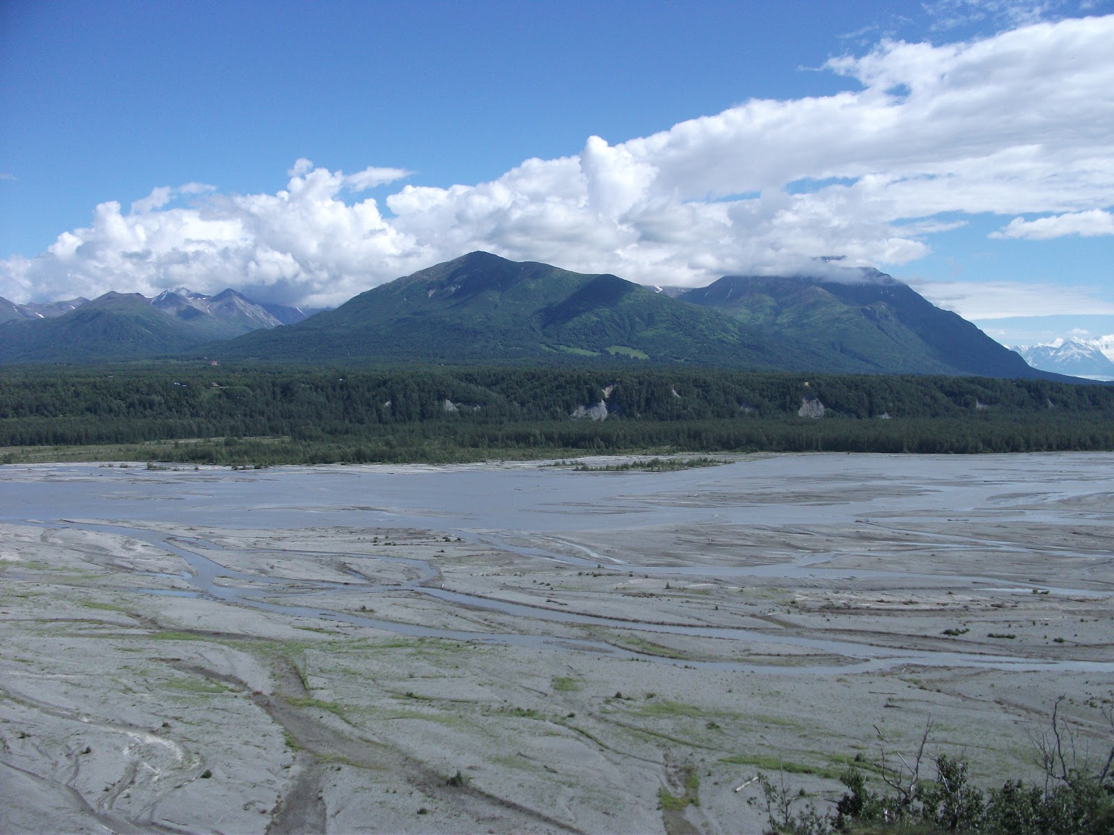
Dave and Kathy drive north on Glenn Highway, past the Musk Ox Farm and Reindeer Farm, so we can see the Mantanuska Braided River, an eerie looking river fed by the Mantanuska Glacier.
 |
| Mantanuska Braided River |
 |
| Note the bluish tint |
Sixty miles later, we see the Mantanuska Glacier off the side of Glenn Highway. We think about taking the walking tour, but aren't fully prepared for the elements. Only our first day and we are trying to take in all the magnificent sights, so much greater than our camera lens. As Kathy said, "It's scenic overload."
 |
| Mantanuska Glacier |
 |
| One of many roadside creeks |
We detour off Glenn Highway to the scenic Palmer-Fishhook Road, which takes us to Hatcher Pass, a 3,885 foot mountain pass through the southwest part of the
Talkeetna Mountains. It is named after Robert Hatcher, a
prospector and miner who discovered the first gold claim in 1906.
 |
| Hatcher Pass |
Independence Mine at Hatcher Pass was permanently closed in January, 1951, after mining nearly
6 million dollars' worth of gold, It was entered into the National Register of Historic
Places in 1974. Today, the abandoned and dilapidated buildings are a reminder of Alaska's rich mining history.
 |
| Independence Mine |
Day Two - July 18
Parks Highway North to Denali
The only must see on
our land agenda is Denali National Park. In retrospect, Denali is not
one of our personal highlights due to time constraints and the
difficulty inherent in getting around a 6.2 million acre park. You can only
drive 15 miles into the park by car. To explore the rest of the parkland
open to the public, visitors board an old school bus that takes eight
hours to go 53 miles or 11 hours to go 92 miles - the furthest public accessible point. Not something for a one day trip to the park!
One of the reasons people venture far into the park interior is to catch a glimpse of Mt. McKinley, which at 20,230 feet is the tallest mountain in North America. Alaskans call the big mountain Denali, a native word meaning "The High One". The joke is, in Denali National Park, you have a 95 percent chance of seeing a bear (which we didn't) but only a 25 percent chance of seeing Mt. McKinley (which we did) because the mountain generates its own weather and is often shrouded in clouds.
We view Mt. McKinley late morning from Denali State Park, a 325,000 acre wilderness and camping area at the southwest corner of the national park. The southern viewing point is some 40 miles from the mountain and offers some of the best views -- on a good day.
 |
| Mt. McKinley on the right is a bit shrouded but still visible |
 |
| Deception Mountain in the middle foreground is often mistaken for McKinley |
 |
| Denali State Park viewpoint south |
We are amazed by the lack of traffic driving to Denali National Park - but judging by the packed parking lots, everyone arrived there before us. We check in at the Wilderness Access Center, grab some sandwiches and head to the Denali Visitors Center, where we see a nice film and interesting exhibits.
The best part of the abundant day light is you don't have to feel
rushed. We
drive 15 miles to the Savage River Loop Trail, and don't start hiking there until late afternoon. Set in an idyllic mountain valley, the uneven rocky trail
loops around a sometimes meandering, sometimes rushing river with
wildflowers and wild life.
Right before the bridge to the other side,
Jeff stops to take photos of a towering rock jutting off the hilltop.
That's when he spots movement in the brush and is lucky enough to spy
a lynx pounce on his prey. He takes a few photos with our little
digital, then alerts a passing photographer with a large close-up lens.
Content with his lunch, the lynx very obligingly lets Steve photograph
him while he dines and then poses awhile longer before escaping into the
bushes. The awesome lynx photos below are courtesy of Steve Thomas.
 |
Steve at work
|
We chat with Steve's friend Kitty who moved to Fairbanks
from California and is the quintessential Alaskan woman. I'm surprised
to discover that Kitty, a petite, soft-spoken woman with a nice smile, is an avid angler and hunter.
When Jeff
describes the larger than expected size of the lynx's paws, Kitty
said, "Maybe I shouldn't tell you this, but I once put my hand inside a
lynx's foot. That's how large it is."
Kitty also remarks that living in Alaska is like living in a postcard. Before we say our goodbyes, Kitty points out a ptarmigan bird
with her babies, so Jeff zooms in to get a few shots. They are brown now, but their plumage turns white in the winter.
 |
| Ptarmigan |
We decide to
hike another trail Steve suggests before leaving the park. As we
start the descent toward Horseshoe Lake, I spy a moose wading and
feeding in the water below. Finally! For all the talk of moose
habitation in and around Anchorage, this is the first one we see from a distance.
 |
| Horseshoe Lake |
 |
| Our first moose sighting |
After all the hours it took to drive from Anchorage to Denali, now we have to start our drive back. Anywhere else, it would be getting dark but not in Alaska. We detour off Parks Highway to Talkeetna, a quirky little bump in the road which
is a staging area for many climbing expeditions. Called the Doorway to Denali, It was founded at the
turn of the century as a supply station for miners and trappers and
maintains the rustic look even today. Historic buildings line a
one-block main street and many locals live in log cabins. Suddenly the
road ascended just enough to offer us another
panoramic view of the McKinley.
 We make the last
seating at the Wildflower Cafe, have a wonderful salmon dinner, then
walk through town.
We make the last
seating at the Wildflower Cafe, have a wonderful salmon dinner, then
walk through town.
 |
| Sunny Main Street at 10 p.m. |
 Before heading back to Anchorage through Sarah Palin's hometown of
Wasilla, we stop to watch what we thought was a co-ed softball game
being played in the 10 p.m. light of night. We laugh to see a motley
crew of Talkeetna townspeople playing beer can kickball. They hold onto
their beer, in the kicker's box, running the bases or out in the field.
We arrive back at our hotel just as the sky turns dark for a few hours, at
around 1 a.m
Day Three - July 19
Seward Highway South to Whittier
Before heading back to Anchorage through Sarah Palin's hometown of
Wasilla, we stop to watch what we thought was a co-ed softball game
being played in the 10 p.m. light of night. We laugh to see a motley
crew of Talkeetna townspeople playing beer can kickball. They hold onto
their beer, in the kicker's box, running the bases or out in the field.
We arrive back at our hotel just as the sky turns dark for a few hours, at
around 1 a.m
Day Three - July 19
Seward Highway South to Whittier
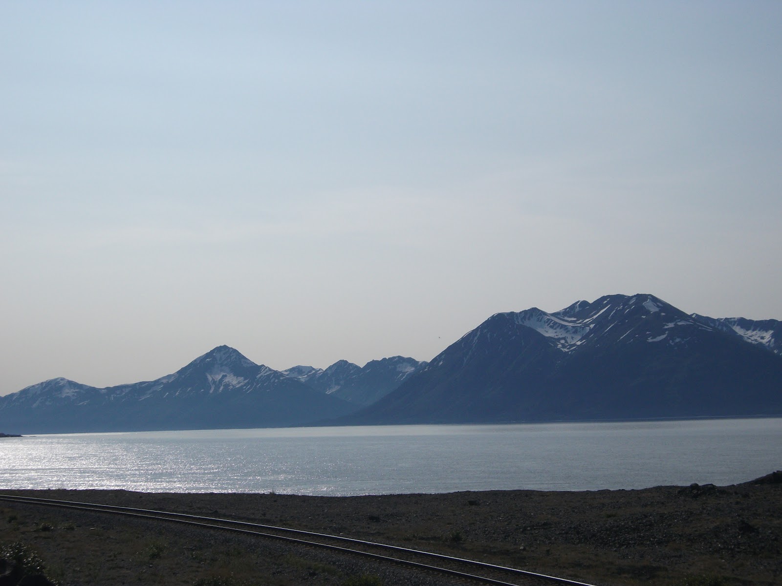
Driving south from Anchorage on Seward Highway, a National Forest Scenic Byway and one of 15 roads in the United States designated as an "All-American Road", is more spectacular than driving north to Denali.
Within minutes, we're driving along Cook Inlet to Turnagain Arm with the 3,000 foot mountains of Chucagh State Park on the left and steep snow-dotted mountains across the water. Our first stop, Beluga Point is known for whale sightings but all we got were sweeping views of gorgeous Cook Inlet.
 |
| Looking for Dall sheep on the cliffs |
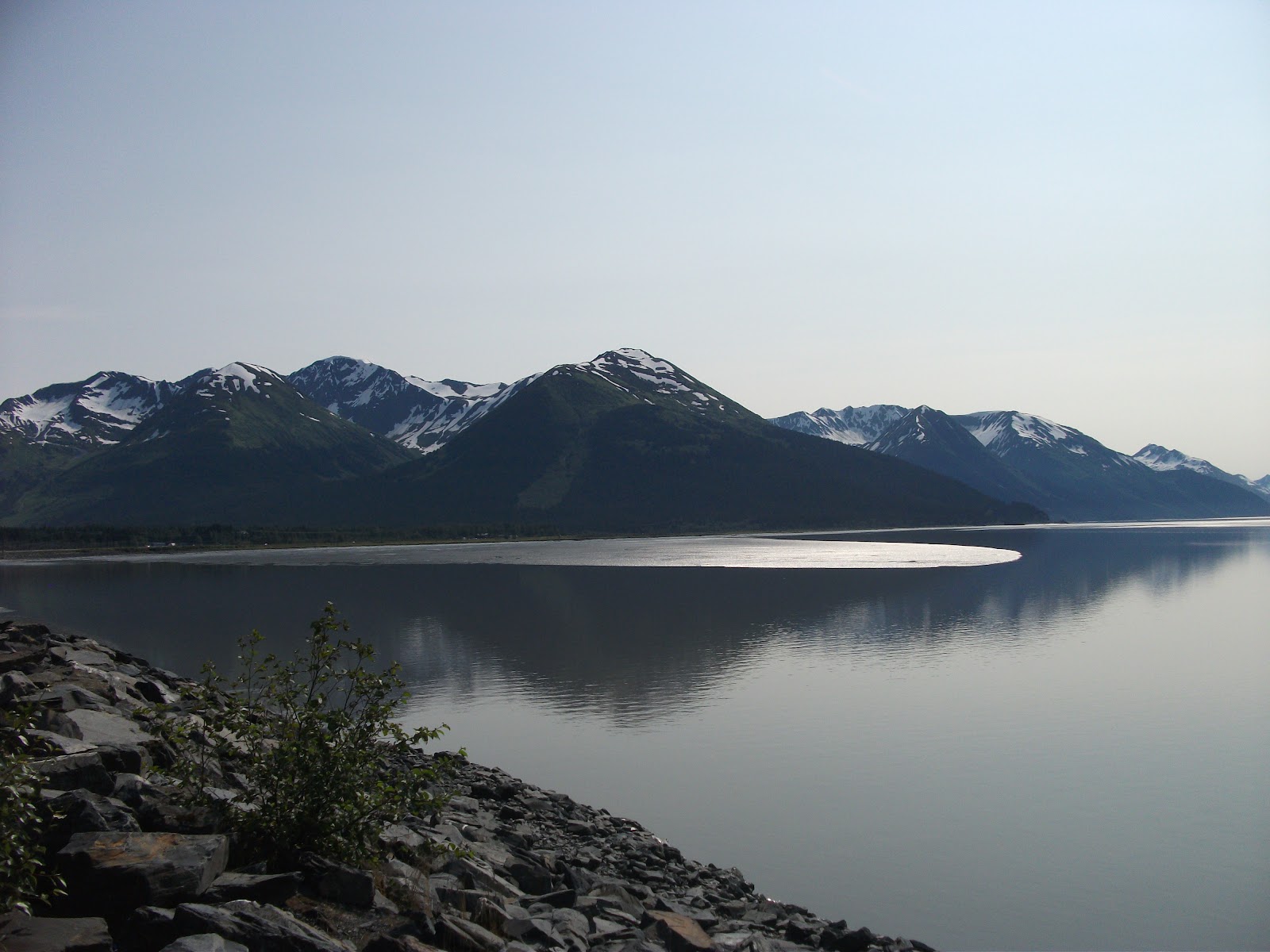
Traveling south along Turnagain Arm, the verdant mountains are striped with snow.
 |
| Any sheep up in them mountains? |
More funky Alaska in Girdwood, another gold mining town founded in 1900 by James Girdwood. The 1964 earthquake sunk the town into Turnagain Arm. It was rebuilt two miles further inland in an idyllic valley next to Mt. Alyeska, Alaska's premier ski resort.
 |
| Giant Queen Anne's Lace |
 |
| One more beautiful hiking area |
One
thing we learn in Alaska is you just keep forging on and stopping at
one awesome sight after another. Seward Highway continues past Turnagain
Arm to Kenai Peninsula and the town of Seward. We continue as far as
the Portage Valley, stopping at Portage Lake and Glacier, before heading
east to Whittier on Prince William Sound. No cruise ships are in port the day we visit, so we are surprised to later discover that this is our embarkation location, not Anchorage as we incorrectly assumed. (Ticket said Anchorage/Whittier. Laurie is the one who catches the distintiction, thank goodness, or we may have missed our ship.)
 |
| Portage Lake and Glacier |
We are learning, getting around Alaska is not always as easy as it appears.
The mountain below was a mammoth obstacle for prospecting miners and for Chugach Indians traveling from Prince William Sound to fish in Turnagain Arm. In 1941, the U.S. Army started construction on a railroad line from Whittier to Portage to aid in the war effort. The 2 1/2 mile Anton Anderson Memorial Tunnel below, designed by army engineer Anton Anderson, was completed in 1943, thereby establishing the town of Whittier. When the army pulled out in the 1950's, Whittier became a commercial port. The army also built two high rise buildings, where most of the town's 300 people live today, according to a shopkeeper who raised her children in Whittier. Whittier is 60 miles southeast of Anchorage.
Because the tunnel is one way, the traffic route switches every half hour, taking about 15 minutes to pass through. I keep my eyes closed to avoid feeling claustrophobic, so the interior photo is from the internet.
 |
| Entering the tunnel |
 |
| Talk about not seeing the light at the end of the tunnel |
 |
| Never so happy to see a town sign |
 |
| Whittier's another funky Alaska town |
 |
| Port on the edge of town |
 |
| Our lunch spot on Prince William Sound |
We stop at Portage Lake on our way back to Anchorage and this time, we see an iceberg that calved off the glacier. Jeff wants to bring a piece of ice home but well - I explained what would happen.
 |
| Doesn't look so large... |
 |
| Until you see the kayakers | |
|
|
|
|
|
 |
| Bird Creek |
On our way back to Anchorage,
we stop at a few mile markers we missed the first time around. Lucky local residents live about a half hour away from Bird Creek, nestled at the foot of the Chugach Mountains amid fir and spruce trees. They actually catch salmon in Bird Creek and at Ship Creek in downtown Anchorage.
Another beautiful area just south of the city is the McHugh Creek picnic and hiking area.
 |
| 20 foot waterfall into a creek |
 |
| We don't have to hike far to find this rushing creek |
 |
| Sweeping view from the top |
Day Four - July 20
Downtown Anchorage
Laurie and Harvey, our cruise mates, arrive later today so we stay close to home and explore downtown Anchorage and its environs. (Laurie and Jeff went to high school together and we see them when we go back for HS reunions and to visit Jeff's family.) We hear there is a noon time concert downtown and "lots of hot dogs stands".
 |
| Bear Square |
 |
| Reindeer? |
 |
| We're only 2839 miles from Chicago |
 |
| A little bit blues, jazz and pop |
 |
| Anchorage is a mix of old buildings and high rises |
 |
| Look what I find |
We also tour Earthquake Park on Knik Arm south of downtown. The park is set in a wooded area where an entire neighborhood slid off into the ocean during the 1964 earthquake. We end our pre-dinner excursion by driving up Glen Alps Road, where we are lucky enough to see a mother moose and her baby dining along the road.
The road ends on the top of Flattop Mountain, a broad summit that was shaped by the grinding action of ancient glaciers. The scenery felt a little like "Sound of Music".
 |
| Imagine this view on a clear day |
Day Five - July 21
Sail Away
We have sunny weather - until today. We board the bus to Whittier with Laurie and Harvey at the Anchorage Airport, after a nice dinner last night at the Glacier Brewhouse.
One more time through my favorite tunnel to the Sapphire Princess, our home for seven days.
 |
| Harvey started the cruise off right... |
 |
| with pina colada soup |
 |
| Leaving Whittier at 8 p.m. (notice residential building I spoke about earlier) |
Day Six - July 22
At Sea - Yakutat Bay
Our first cruising night and day, Sapphire travels south 87 nautical miles and enters Yakutat Bay around 3 p.m. Two pilots board the ship to help our captain John Foster navigate the icy waters of Disenchantment Bay, the gateway to Hubbard Glacier. The day is overcast, the wind is cold and the scenery is icy. We watch in anticipation amid the crowd of people on deck, cameras poised, wet with spray and feeling adrift in a foggy foreign world. Our view is not as great as on a clear day, but the fogginess adds to the otherworldly beauty.
The Hubbard Glacier is North America’s largest tidewater glacier, stretching 76 miles long from its source in the Yukon to Alaska, the face is 7 miles wide, and about 300 to 400 feet high with another 300 feet below the waterline.
 |
| Approaching Hubbard Glacier |
 |
| Disenchantment Bay is strewn with icebergs, which are larger than they appear with the majority below water |
|
|
|
 |
| Harvey, Laurie and Jeff chillin' on deck |
 |
| We learned why glaciers look blue? When light hits the highly compacted ice, short wavelength colors (blues) reflect back through the ice to our eyes. |
 |
| Leaving Yakutat Bay |
Our first full day at sea culminates in a formal evening.
 |
| Marianne and Jeff |
 |
| Laurie and Harvey |
Day Seven - July 23
At Sea - Glacier Bay
Our 35th Wedding Anniversary
Sapphire travels from Yakutat Bay through Icy Strait to Glacier Bay - which is 459 nautical miles, a lot further than we traveled yesterday. Because Glacier Bay is a national park and preserve, a couple park rangers board our ship at Bartlett Cove to provide commentary and presentations and once again help the captain maneuver through the waters. Our ultimate destination is Margerie Glacier, one of the state's most active glacier faces. Margerie is about one mile wide, with an ice face that is 250 feet above the waterline and a base about 100 feet below sea level.
While others are contemplating the grand scenery, we start the day with a personal milestone on the 35th anniversary.

 |
| Hmm..Is Jeff contemplating the scenery or his love for me? |
No cruise blog is complete without a few food photos. Princess acknowledges our anniversary with a picture-perfect luncheon buffet. We happen upon it and quickly call Laurie and Harvey to join us.
 | |
| Chef Photo Op |
Sapphire parks in front of Margerie Glacier for an hour or more, giving us front row seats
to the awesome spectacle and frequent calving that takes place. First, there is a thunderous boom, then a giant splash as a piece of ice calves off into Glacier Bay - which is 1,000 deep in most spots.
 |
| How insignificant we are in Nature |
 |
| Avalanches, rock slides, tributary glaciers and scouring of the valley causes Margerie's accumulation of dirt and rock |
 |
| Chilly but nothing like yesterday |
 |
| WOW |
 |
| From where we came |
 |
| Frozen waterfall |
 |
| After a calving |
 |
| Brave little boat |
We enjoy a lovely anniversary dinner in the Vivaldi Dining Room - with an oceanview table, of course, and Princess signature dessert - complete with chocolate embossed logo.
 |
| Caramel topped layer cake |
Day Eight - July 24
Skagway
We dock in Skagway, our first port since boarding Princess, at 7 a.m. after traveling 115 nautical miles. Skagway, which means "a windy place with whitecaps on the water", gets its name from the Tlingit people. The village is the Gateway to the Yukon and the Klondike Gold Rush of 1898. It's interesting to note that we traveled down Icy Strait and up the Upper Lynn Canal to reach Skagway which is east of Margerie Glacier and almost as far north, at the northernmost tip of Alaska's Inside Passage.
Skagway is somewhat famous for its own form of graffiti. The cliffs are painted with ship and captain names - the more popular the captain - the higher his name.
We board a coach with our entertaining 24-year-old driver Megan for our Yukon excursion and travel north on the Klondike Highway into British Columbia. The scenery is, of course, spectacular.
We stop to take photos of the bridge we passed over, which is listed on the Internet under the world's scariest bridges. The Captain William Moore Bridge is a 110-foot cantilever bridge completed in 1976. It is anchored securely on only one end so it isn't torn apart when the ground shifts. Why? Because it's positioned over an active earthquake fault.

Next stop - Yukon Suspension Bridge at Tutshi Canyon just a few miles north of White Pass Summit. The swaying walkway hangs 57 feet above the white water rapids of the Tutshi RIver.
We have fun at the exhibits before crossing the bridge.

 |
| Harvey, Laurie and friend |
 |
| Jeff halting traffic |
 |
| View from the middle |
 |
| Bear Sighting |
 |
| This sign was very popular for photo ops but we took ours with the sign below |
 |
| Known as the world's smallest desert at 1 square mile or 640 acres |
We had lunch at the Caribou Crossing Trading Post, a tourist stop with a wildlife museum, gift shop, petting farm and Iditarod dogs and puppies.
 |
| My personal favorite |
 |
| Iditarod puppy |
 |
| Dog Houses |
 |
| Winter travel |
 |
| This little guy roamed among the crowds |
Historic Carcross is a scenic village with buildings dating back to 1898 and home of the Carcross/Tagist First Nation. It is 67 1/2 miles northeast of Skagway.
 |
| White Pass Depot |
 |
| General Store |
 |
| Carcross Railway Swing Truss Bridge - once used to let steamers out of Lake Bennett |
 |
| S.S. Tutshi constructed in Carcross in 1917 and burned to the ground in 1990 |
 |
| "Inukshuks" statues built in
the likeness of a human in the Inuit language. |
 |
| Jeff leaves his mark |
We end our day back in Skagway.
 |
| Arctic Brotherhood Building uses 1,000 sticks of Driftwood |
 |
| They let me choose the dinner wine and this is what I chose |
Day Nine - July 25
Juneau
We travel 101 nautical miles south along the Inside Passage from Skagway to Juneau, the capital of Alaska. Surprisingly, there are no roads to Juneau. You can fly there or arrive by ferry or cruise, but you can't drive. Juneau does have an international airport, but none of the airlines we consider major fly in there. There are still plenty of people milling around this pretty town which has a population of about 32,000 and lots of cruise ship visitors.
 |
| Many residents own their own sea plane |
 |
| Flowers as tall as Jeff |
Laurie and Harvey head out early this morning for a helicopter ride and glacier dog sled adventure. We opt for the Mendenhall Glacier Float Trip, which includes views of the 1.5 mile wide Mendenhall Glacier and the surrounding mountains. Part of the trip includes white water rapids, but Matt, our guide from Spring Green, Wisconsin, suggests putting our cameras away.
 |
| Ever feel like Ronald McDonald? |
 |
| Mendenhall Glacier |
 |
| Summer homes |
 |
| A couple rafts get stuck on rocks, but Matt moves us through without a hitch |
Laurie discovered on Facebook that a former English teacher from Woodland High School lives in Juneau and arranges a brief meeting.
 |
| Mary Lou with her star students |
A few final shots of Juneau before our early 3:30 p.m. departure.
 |
| Governor's Mansion hidden behind that tree |
 |
| Looking back from the ship |
 |
| Sail Away |
Day Ten - July 26
Ketchikan
We travel 287 nautical miles south from Juneau to reach Ketchikan, our last port of call and the southern most town on the Inland Passage. If you think you've never heard of Ketchikan, think again. This is the proposed site of the "Bridge to Nowhere" that then Gov. Sarah Palin killed in 2008. Ketchikan International Airport is located on Gravina Island across the Tongrass Narrows from the town on Revillagigedo Island. The joke is airport parking is free. The ferry to the airport is $5 each way.
 |
| Town buildings on the left, cruise ships on the right |
Ketchikan lays claim to the largest collection of totem poles in the world. There are 80 in the town alone. This one at Whale Park is
the Chief Kyan Totem pole. Known as a lineage pole, it has three figures. The Crane at the top represents the chief's wife, middle Thunderbird represents her clan, and the Bear at the bottom is Chief Kyan's family crest.
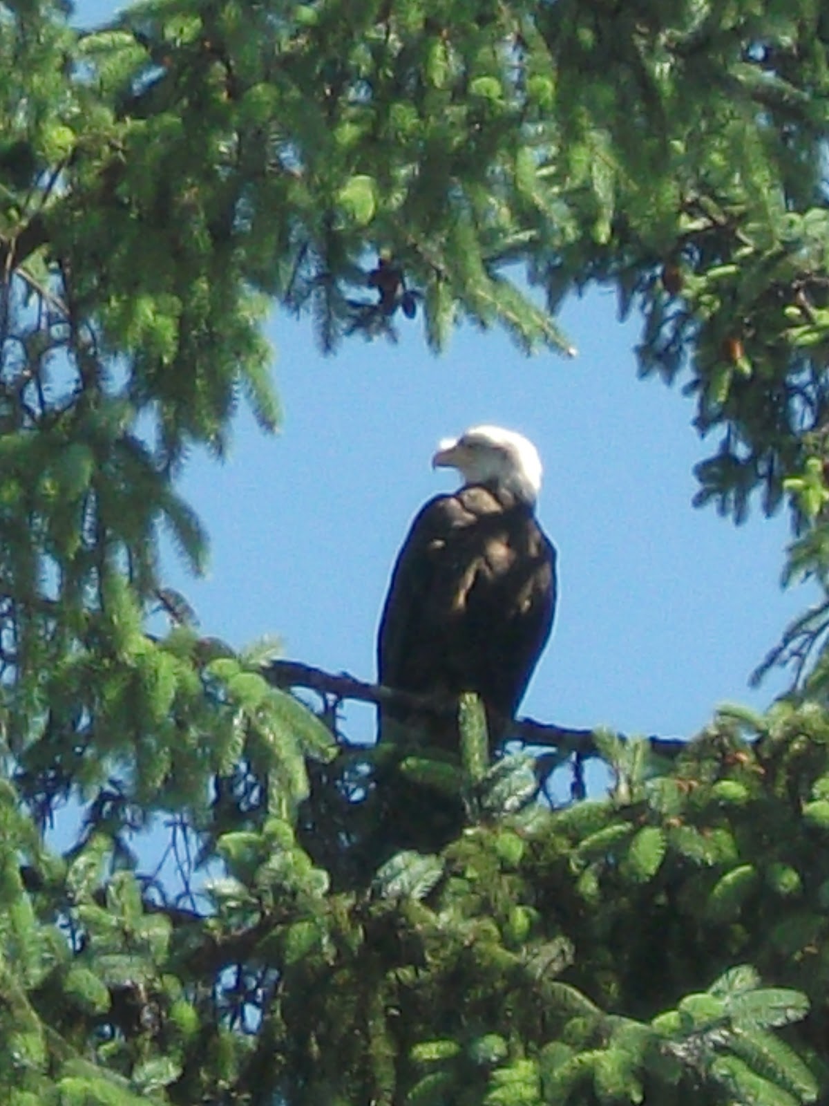
Our excursion of the day is to Alaska's rainforest.
We board a seahawk for a brisk ride across Clover Passage to a secluded beach, stopping to view seals and eagles along the way.
 |
| Laurie and Harvey from Jeff's angle | |
Our guide Maggie takes us on a hike through the ancient Tongrass National Forest, which is the
nation's largest national forest at almost 17 million acres (almost 5.7
million acres has been designated as wilderness).
 |
| Maggie introduced us to BOB with leafy hair |
 |
| Eagles are plentiful |
Back in Ketchikan--
 |
| A Totem that honors the Tongrass Tlingit People |
 |
| We see salmon jumping in the creek on Creek Street |
Creek Street is a historic boardwalk perched on pilings along the
banks of Ketchikan Creek and a former Red Light
District where both men and salmon swam upstream to spawn. Fisherman, miners and gentlemen found entertainment and female companionship at #24 Creek Street, otherwise known as Dolly's House. "I realized I could make a lot more money from the attentions of men than I could waiting tables." -- Dolly Arthur
 |
| Dolly's House is now a museum |
 |
| A refreshing end to our day in port... |
 |
| on the patio of Arctic Bar |
Day Eleven - July 27
At Sea
We go to a Culinary Demonstration, mainly because it culminates in a tour of the galley, something I am curious about and interested in touring. The Maitre d' is a good straight man to the Chef, who is humorous and very comfortable and proficient in front of a large audience.
 |
| Maitre d'Hotel Beppe Castino and Executive Chef Nilo Palma on stage |
This is one of three galleys for the ship's restaurants seven formal restaurants as well as buffets and other quick casual dining areas. Palma has 155 crew members who slice, dice, bake and cook and only three of them are women.
 |
| Autographing their cookbook |
Our last cruise day is chilly again - but we had such great weather in our ports, we don't complain.
All good things must come to an end. We share one more dinner this Laurie and Harvey, this one a very special dinner to celebrate their 37the wedding anniversary, which is on August 2.
 |
| Pair of Ducks |
 |
| Happy Anniversary Laurie and Harvey |
 |
| From your friends at sea |
 |
| A sweet ending to a wonderful cruise |
Day Twelve - July 28
Vancouver
We travel south 543 nautical miles from Ketchikan to Vancouver and have to go through customs before boarding our plane Seattle. We fly Seattle to Vegas, with a five hour layover and a trip to Paris (Casino). We arrive home in Chicago at 6 a.m. July 29.
 |
| Vancouver - the end of the line |
Final thoughts on Alaska
If you're been to Alaska, you know that
photos don't do it justice.
If you have not visited Alaska, you won't be
disappointed.
All I could think is Alaska is what the world looked
like at creation before it was altered by man's footprint. And what it
will look like again when God restores the earth to its original
splendor. I'm not saying it's absolutely the most beautiful place on earth - I
haven't traveled enough to judge - but it's impossible to describe the vastness
of what they call the "last frontier" - the height, the breadth and the
depth - of the mountains, the valleys and seas until you visit. From the ice blue glaciers to the verdant countryside and brilliant blossoms, from the towering snow capped peaks to the glassy sea, Alaska
is a land of contrasts.
I felt much like I did at the top of Santorini,
Greece, looking down at the immense ocean expanse - feeling like you're no place on earth - but in the dwelling place of God.
We chatted with a native young lady, who workes at the Palmer Vistor Center. She pointed out her home on a map - a villlage called Kipnuk on the Bering Sea with a population under 650 people. It is southwest of Bethel, the closest big town with a population 10 times that of Kipnuk. She told us there are no roads leading to her home, she has to fly - which we later found out is somewhat common place in Alaska. One of her favorite meals is reindeer stew and whale blubber in seal oil. She does attend a boarding school, I think she said in Sitka, which is a long way from her home but close to Juneau the capital and the area we explored by ship. There are more opportunities for her away from her family.
Most other people we talked to were transplants from the lower 48 who came, fell in love and never left. Or young people on summer breaks from college or more permanent breaks trying to decide what they want to do with their lives. Lots of wide open places for soul-searching. We also talked to fellow tourists who are on their second, third, fourth, fifth etc trips to Alaska - by RV and/or cruise ship. Our ship naturalist Sandy remembers visiting her grandmother summers in Yakutat Bay near Hubbard Glacier and staring out the window at the light night sky. Retired, she now spends 4 1/2 months on Princess lecturing or talking one of one with people about glaciers, whales and all the wonders of Alaska. We had a nice chat the first morning at sea, when we forgot to reset our clock and showed up for her presentation an hour early, wondering where everyone else was.
So we have a foot in the mammoth door of Alaska but there's much more to see. We didn't fully explore Denali or make it north to Fairbanks. We didn't see Homer - the fishing village where Aunt Carnie and Uncle Jerry lived for years and Jeff still has cousins. We heard Sitka is gorgeous and Valdez is the largest port on Prince William Sound.
And we only saw the flip of a tale and the blow of a whale from a distance.
|
|
|
|
|
|
|
|
|
|
|
|
|
|
|
|
|
|
|
|
|


No comments:
Post a Comment